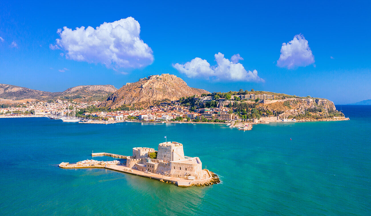
NAFPLIO
A special place, mysterious, blessed, full of natural beauty and culture. Spectacular scenery meets gorgeous beaches and medieval atmosphere. It was the capital of the First Hellenic Republic, since the start of the Greek Revolution in 1821 until 1834. Its beauty is well known worldwide.
Most important sites are Palamidi Castle with 913 steps leading you from the town to the fortress, built by the Venetians circa 1711, and used much later as a prison for Theodoros Kolokotronis himself, hero of the Greek revolution, and Bourtzi Island, a tiny islet facing the Nafplio port, where Antonio Gambello built a fortress designed to fit the narrow shape of the island in 1417.

SANTORINI ISLAND
Santorini is worthily considered one of the most famous and highly desirable destinations on earth. Just think that, apart from the usual pictures, there is an entire island of beauty, incredible beaches, sights and attractions, more than enough to make Santorini a famous destination. The fascinating legend of the island that emerged out of the lathered sea - an island cut into two, the globally unique archaeological riches, the sublime folk architecture and the magic that no picture can capture make Santorini an island of surprises which reveals its true face when summer visitors are gone, out in the open sea.
Santorini or Thera is at the far south of the Cyclades, together with Anafi. It covers an area of 73 square kilometers, in a circular arrangement together with Therasia and Aspronisi. In the center of this circle is the caldera created after the major volcanic eruption in 1650 BC. Inside the caldera, underwater eruptions caused the emergence of the isles of Palea Kameni and Nea Kameni - a unique phenomenon in the entire world. The view as the yacht approaches the island is breathtaking! A steep reddish-black rock of 300 meters, the caldera walls, stands imposing. And as the yacht approaches, human presence can be discerned - small houses and blue church domes - an impressive sight! Don't miss the chance to walk the route Fira - Firostefani - lmerovigli - Oia. The view to the caldera is unique in the world.
The beaches of Santorini, with their characteristic black or reddish sand, are charming in a special way: Exo Gialos, the Red and the White beach, Mesa Pigadia with the unique cave, Vlychada with the yellowish weathered rocks that form small caves and natural sculptures - a magnificent scenery! The settlement of Kamari features a very long beach and Perissa an endless beach of black sand and dark blue waters. Perissa is also the settlement where the largest church of Santorini, Timios Stavros (19th century) is located. In Pon, one can admire the large church of Panagia Kalou (1650) and enjoy swimming at a remote sandy beach.
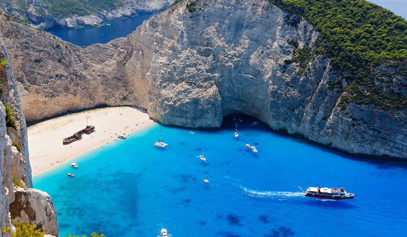
ZAKYNTHOS
Zakynthos (or Zante) has different type of beaches: there are sandy beaches inside secluded caves where the waters are deep and blue. The perfect destination for superb beaches, great nightlife, beautiful scenery and ideal watersports destination.
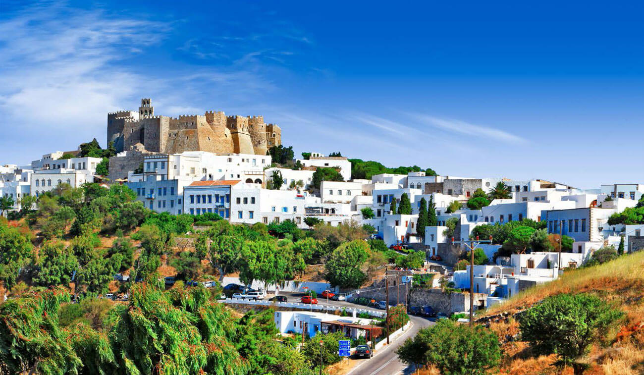
PATMOS ISLAND
Worldwide known as a sacred island for it is the place where Saint John wrote the Book of Revelation, Patmos is an ideal destination for nature lovers thanks to its lace-like coastline, sheer cliffs and volcanic soil.
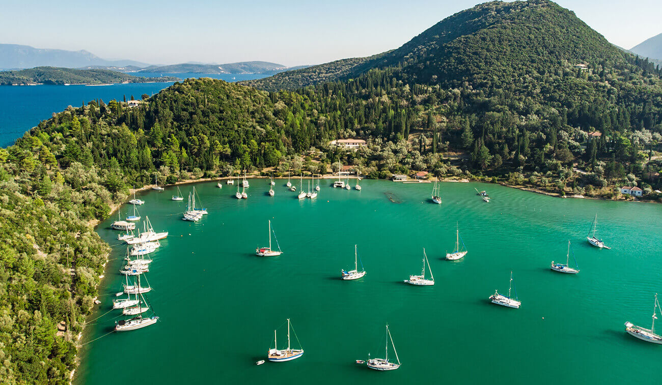
LEFKADA
Lefakada is surrounded by of 24 isles – one of them is the Aristotle Onassis’ Scorpios. There you will find sightseeing, churches and monasteries, coves of transparent, turquoise waters, traditional houses and restaurants. You will definitely come again and again to see the hall island.